
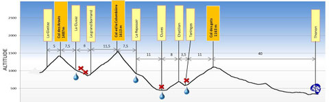
Etape 12 : La Giettaz - Thonon


En résumé
- 111 km jusqu'au Camping + circuit de 10 km pour arrivée au Km 0
- D+ : 1930 m / D- : 2660 m
- Col des Aravis - Col de la Colombière - Côte de chatillon -Col des Gets
Profil
Trace Google Earth

Carte
Photos


